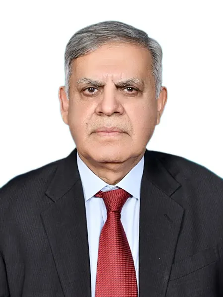
Shahid Pervaiz
Civil Engineer & Project Manager
48+ years of civil engineering experience designing and delivering roads and major infrastructure projects, combining international engineering practice, project and design management, and practical engineering software development. Over 24 years with leading international consultancies across the Middle East and 24 years of professional experience in Pakistan. Currently General Manager (Transport) at SMEC International.
CV Summary
00 / One-Page Overview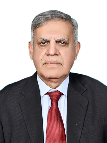
Shahid Pervaiz is a highly experienced Civil Engineer with 48 years (24 years in UAE/Oman/KSA and 24 years in Pakistan) in the design, management, and delivery of expressways, highways, and urban road projects across Saudi Arabia, Oman, UAE, and Pakistan. He has worked with SMEC International, KEO, Parsons, Halcrow, and NESPAK, holding key leadership roles in project and design management.
Current Role
General Manager (Transport) — SMEC International
- Managing multidisciplinary teams to deliver major road infrastructure projects.
- Overseeing feasibility studies, detailed designs, and technical proposals.
- Preparing technical proposals for highways, BRT, motorways, and urban and rural roads projects.
Key Expertise
- ✓Project & Design Management — Leading large-scale road and infrastructure projects from concept to execution.
- ✓Technical Leadership — Coordinating with clients, stakeholders, and contractors to ensure smooth project execution.
- ✓Highway & Infrastructure Design — Experience with expressways, interchanges, bridges, and urban road networks.
- ✓Software & Tools — RoadCalc, Geopak, InRoads, MicroStation, MS Office, Python, Visual Basic (VB5) and VB Excel.
Education & Certifications
- B.Sc. Civil Engineering, UET Lahore (1978)
- Member, Pakistan Engineering Council (CIV-3794)
- Project & Budget Control Training (Parsons, PMI-PMP)
Contact
Email: pervaiz.shahid@gmail.com
Notable Design Projects — Sr. PM / Design Mngr. / Team Leader / Resident Engr.
National
- West Marina (3,000 acres), SMEC/EGC — Detailed design of mixed-use urban development in Lahore, Pakistan.
- Mashkhel Panjgoor Road (200 km), SMEC/EGC — Feasibility study and detailed design including bridges.
- Sibi Cluster Roads (582 km), SMEC/EGC — Preliminary design of roads, drainage structures and tender documents.
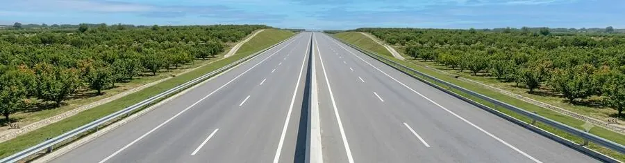
- Swat Motorway (80 km, Pakistan), SMEC/EGC — Detailed design of 8 interchanges, 12 long river bridges, 22 subways, 10 underpasses, service areas, toll plazas and 59 box culverts.
International
- Al Falah Urban Roads in Abu Dhabi — (SMEC/EGC) PAK
- Internal Roads for the Saham Agricultural City Development in Oman — (SMEC/EGC) PAK
- Fence Road in KSA (500 km), (SMEC/EGC) PAK — Bid design of 500 km fence road and link roads.
- King Abdul Aziz Road, Makkah (KEO), KSA — Design management of metro, BRT and infrastructure.
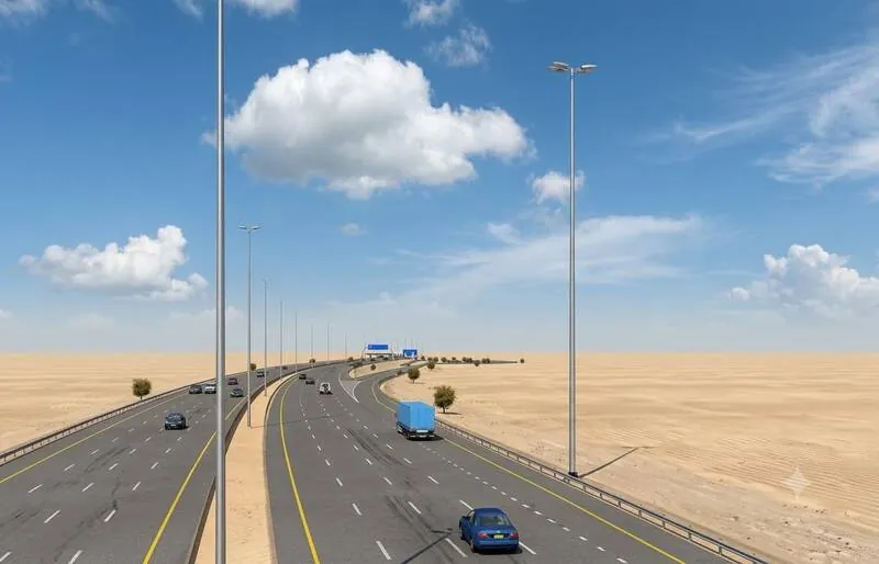
- Batinah Expressway (187 km, Oman), (Parsons) Oman — Managed detailed design of a 187 km, 4+4 expressway, 17 interchanges, 25 long bridges, drainage systems and tender documents.
- Upgrading of Existing Batinah Highway Junctions, (Parsons) Oman— Managed the team delivering the design of 24 interchanges, including elevated U-turns and an elevated roundabout replacement.
- Dualization of Adam Thumrait (718 km, Oman), (Parsons) Oman — Managed detailed design of the 718 km dualization, 44 interchanges, camel crossings and drainage structures.
- SEZAD, Duqm Port, Oman, (Parsons) Oman— Design of a 6-lane dual carriageway in the industrial zone, including drainage network, ground improvement and street lighting.
- Saadiyat Island Development, Abu Dhabi, (Parsons) Abu Dhabi — Led the design of a 2,700-hectare urban development, SPUI, directional interchanges, 600 m tunnel, expressways, arterial, collector and sector roads.
Profile
01 / IntroductionShahid is a Civil Engineer and a Project Manager with 48 years of diverse experience in the design and delivery of roads infrastructure projects with 24 years with international consultancy firms in the Middle East and 24 years in Pakistan.
Most recently, he has managed the design team to deliver multiple major projects from strategic concept to detailed design. Shahid is a strong team player, a strong communicator, has a good attitude and is passionate about his professional development and that of those around him. He enjoys client interface and taking ownership and accountability of his projects.
Design management; project management; client coordination; stakeholder coordination; resource management; design support during construction.
Accountable for meeting project milestones, objectives and deliverables within agreed timeframes and budgets.
Develop, maintain and deliver fit-for-purpose project management plans and progress reporting, ensuring the appropriate alignment and allocation of resources.
Effectively identify, engage, influence and negotiate with key project stakeholders, internal and external including vendors, to achieve project outcomes and benefits.
Work closely with the project owner and sponsors to ensure the project delivers the outcome to meet business requirements.
Monitor project actuals, forecasts, and benefits against budget allocation.
Effectively manage the risks associated with the delivery of complex projects through the preparation of detailed mitigation strategies and contingency plans, regular monitoring and control of activities and escalate where necessary.
Understand current IT systems and processes to ensure project change management is appropriately tailored and delivered to the identified audience.
Strong communication, problem solving, conflict resolution and client management skills.
Technical expertise in managing and delivering road and infrastructure projects.
Expertise in technical proposal writing and managing project bids.
Career Alignment
02 / 1978 — PresentGeneral Manager (Transport)
Developing project plans, resource utilization, and budgets. Leads the multidisciplinary design team across major roads and infrastructure projects for clients in the UAE, Oman, Kuwait, and Pakistan.
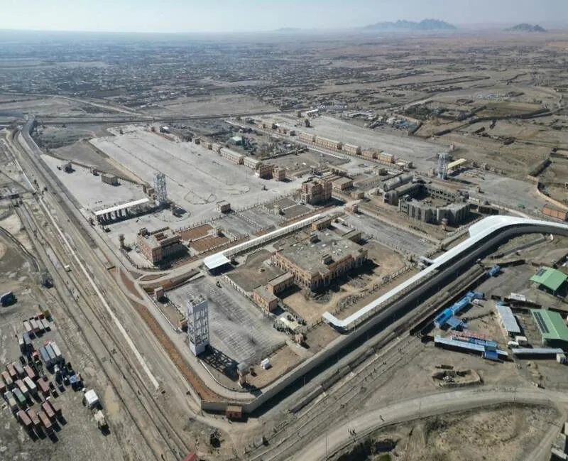
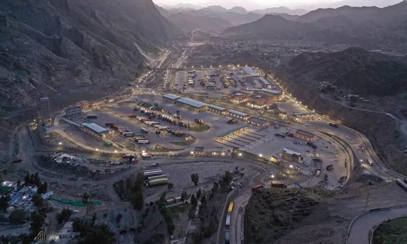
2018-2020 Team Leader of The Border Crossing Point Improvement Project at Torkham and Chaman
Design Manager (Infrastructure)
Design Manager on the King Abdul Aziz Road Project (KAAR), a 3.65 km design-and-construct corridor in Makkah including metro, car parking structures, and a pedestrian boulevard.
Sr. Project Manager
Senior Project Manager on the Batinah Expressway, Batinah Highway Junctions, Adam-Thumrait Road dualization, South Al Batinah Logistics, and SEZAD Duqm Port infrastructure.
Project Manager / Design Manager
Delivered design, drawings, and tender documents for the Mafraq Hotel Staff Accommodation project for TDIC, coordinating utility approvals with Abu Dhabi Civil Defence.
Project Manager / Principal Design Engineer
Principal Design Engineer / Project Manager on Saadiyat Island's road network and bridge, plus Corniche Road land reclamation and East Road widening for Abu Dhabi Municipality.
Principal Design Engineer/Resident Engineer
Delivered detailed design and tender documents for major national highways, Faisalabad-Pindi Bhattian Motorway and Karachi-Dureji-Kakkar Highway. Between 1996-1998 worked as Resident Engineer on Sajaa Khawneej Road in Dubai UAE.
Highway Design Engineer
Design of 90 km of arterial, collector, and sector urban roads in the Al-Suwaidi area of Riyadh.
Site Engineer
Construction supervision of highway earthworks, base courses, asphalt, and concrete works including bridges, culverts, and retaining walls.
Structural Design Engineer
Structural analysis and design for the Mangla Hydro Electric Power Station Extension 7 and 8, on the Jhelum River — the start of a 48-year career.
Selected Projects
03 / Sheet Index Bulk Materials Export Facility — Karachi
Bulk Materials Export Facility — Karachi
Engineering Design and Procurement Services for a Bulk Materials Export Facility - Karachi Pakistan
Reko Diq Mining Company (RDMC) is developing Bulk Material Export Facilities at the Pakistan International Bulk Terminal (PIBT) at Port Qasim Karachi. SMEC scope includes detailed Civil, Structural, Building and Architectural design services to PRDW Africa (Pty) Ltd.
The project involved the development of an export terminal and associated infrastructure under an EPCM framework, comprising site development, internal roads, heavy-duty pavements, utilities, drainage, security facilities, buildings, electrical infrastructure, and supporting civil works.
Managed the multidisciplinary civil and infrastructure design and coordinated interfaces with process, mechanical, electrical, and instrumentation disciplines. The scope included bulk earthworks, internal roads, heavy-duty pavements, parking areas, perimeter fencing, entry gate and access control facilities, potable water supply, stormwater drainage, sewerage and firefighting networks, civil, structural and architectural works for terminal buildings, electrical substation foundations, access platforms, underground cable trenches, and demolition of existing facilities.
The deliverables included the preparation of Design Basis, detailed design drawings, Bill of Quantities (BOQ), technical specifications, and tender documents for the terminal infrastructure and associated facilities. Ensured multidisciplinary coordination, design integration, constructability, and timely delivery of the engineering and tender documentation under the EPCM framework.
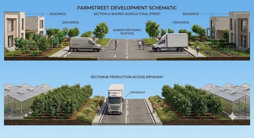 Saham Agricultural City — Farmstreet Schematic
Internal Roads — Saham Agricultural City
Design of Internal Roads for the Saham Agricultural City Development in Oman
The Ministry of Housing and Urban Planning (MHUP), in association with the Ministry of Agriculture, Fisheries and Water Resources, initiated the development of Saham Agricultural City (SAC), a major 65 km² integrated agricultural and urban development aimed at strengthening food security, promoting innovation in the agricultural economy, and supporting sustainable urban development. Approximately 70% of the development area is allocated to agriculture and 30% to urban development, creating an integrated framework for agricultural production, supporting infrastructure, and urban communities.
The project’s transportation infrastructure comprises approximately 95 km of primary access roads, Hamlet/Cluster Streets, and Farm Access Streets, providing connectivity between agricultural areas, urban development zones, and the existing road network. Managed the highway design, including horizontal and vertical alignments, geometric design of intersections and junctions, pavement design, and integration of the proposed road network with existing roads. Optimized the road geometry and connectivity to support efficient access to agricultural and urban areas.
Key deliverables included horizontal and vertical alignment design, roadway geometric design, junction/intersection layouts, pavement design, Bill of Quantities (BOQ), and Engineer’s Estimate, together with coordination of the proposed road network to ensure appropriate connectivity with the existing transportation infrastructure.
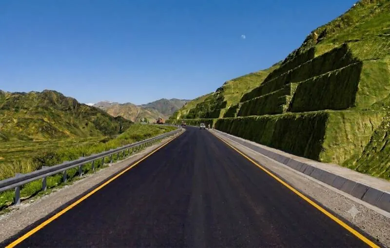 Fence Road & Observation Tower Access Roads
Fence Road & Observation Tower Access Roads
Bid Design of approx. 390 km of Fence Road and 110 km of Link Roads - KSA
The project comprised the detailed design infrastructure including approximately +500 km of Front Fence and Link Roads.
Managed and led the preparation of comprehensive engineering design for the border roads, fencing systems, drainage infrastructure, and associated facilities. Responsibilities included development of project-specific design criteria for roads and fencing, hydrological studies, horizontal and vertical alignment development, plan and profile drawings for roads and fences, standard drawings for border roads and fencing systems, and detailed civil and structural design of culverts and associated drainage works. Led multidisciplinary design coordination to ensure compliance with the Employer’s requirements, Ministry standards, project specifications, and the approved delivery schedule.
Supervised the preparation of Bills of Quantities (BOQ) in accordance with the Ministry of Communications (KSA) format and incorporated the Ministry’s General Specifications into the tender documentation. Developed Special Specifications for works not covered by the standard specifications and prepared the project packaging strategy in accordance with the requirements of the Border Guard, Ministry of Interior, Kingdom of Saudi Arabia. Ensured the delivery of complete, coordinated, technically compliant, and tender-ready engineering documentation.
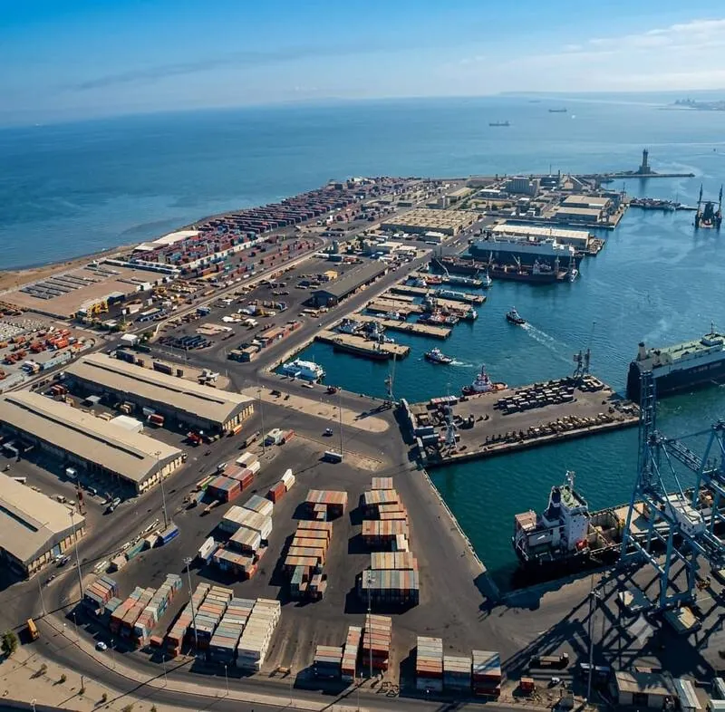 Roads & Truck Parking — Shuwaikh Port
Roads & Truck Parking — Shuwaikh Port
Detailed Design of Roads and Commercial Trucks Parking Facilities for Shuwaikh Port - Kuwait
Shuwaikh Port, located north of Kuwait City, is a major port facility connected to the surrounding road network through Jamal Abdel Nasser (JAN) Street from the south and Ghazali Road from the east. The port's internal circulation network was reconfigured in conjunction with the revised masterplan and reallocated development clusters to improve traffic circulation, enhance connectivity, and accommodate future traffic demand.
Managed the transportation and infrastructure design associated with the port development and extension. The scope included land grading of the port extension and existing port areas, internal road network improvements, roundabouts, car and truck parking facilities, signalized intersections, pavement marking, road and guide signage, stormwater drainage, potable water supply, and sewerage networks. Coordinated the integration of the proposed infrastructure with the existing port facilities and surrounding road network.
Managed and coordinated the preparation of road geometry and alignment designs, junction and roundabout layouts, parking layouts, pavement marking and signage plans, grading plans, stormwater drainage design, potable water and sewerage network designs, and associated engineering drawings and documentation for the port infrastructure works.
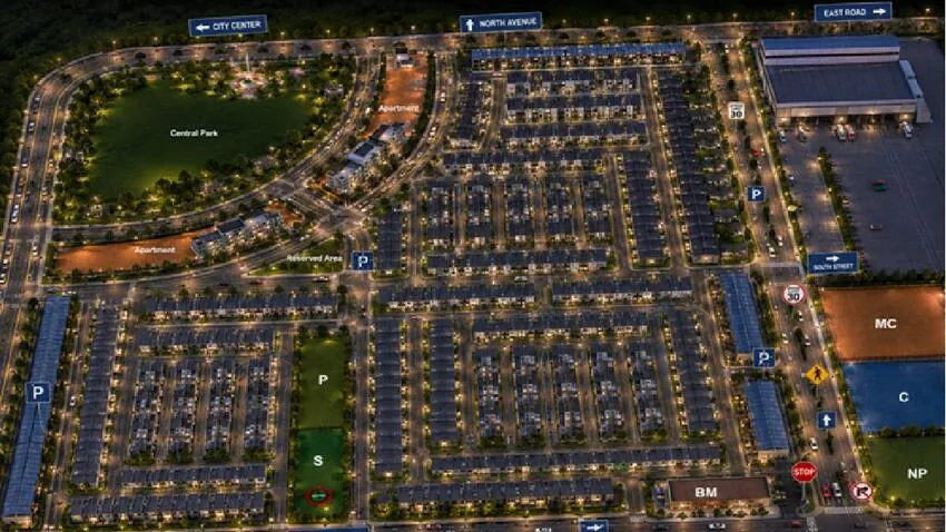 West Marina — Lahore
West Marina — Lahore
Detailed design for West Marina, approx. 3,000-acre mixed-use Urban Development in Lahore - Pakistan
The project is located at the Al-Noor Orchard Housing Scheme, approximately 3 km from the Faizpur Interchange on Main Sharaqpur Road, Lahore, near the motorway interchange. The development was envisioned as a sustainable and well-planned residential community, incorporating modern infrastructure and distinctive features to establish a new benchmark for residential development in the region.
Managed and coordinated the design of land grading, arterial, collector and sector road networks, roundabouts, signalized intersections, interchanges, underpasses, a major bridge over the canal, and wet and dry utility networks, ensuring effective integration of transportation and infrastructure systems with the overall masterplan.
Key deliverables included the detailed master plan, grading design, horizontal and vertical road alignments, geometric design of roads and junctions, interchange and underpass layouts, bridge design, pavement design, wet and dry utility networks, and associated detailed engineering drawings and documentation.
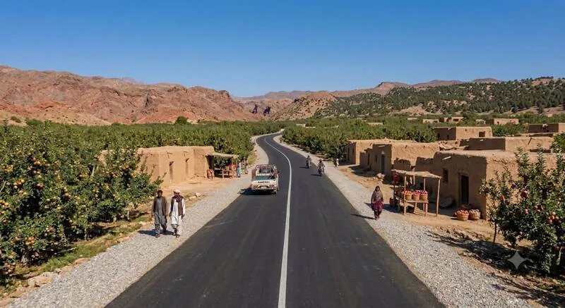 Sibi Cluster Roads
Sibi Cluster Roads
Feasibility Study and Preliminary Design of Roads in Baluchistan - Pakistan
The Sibi Cluster Roads Project comprises approximately 582 km of roads across nine sites in Naseerabad, Sohbatpur, Kohlu, Sibi, and Ziarat districts, traversing terrain from flat plains to mountainous areas. The project aims to improve accessibility to remote areas of Baluchistan, enhance inter-district connectivity, strengthen links with provincial and national highways, and facilitate access to major economic centres, thereby reducing travel time and transportation costs and supporting regional socio-economic development.
Managed and coordinated the highway engineering design of the cluster road network, addressing the varying terrain and site-specific requirements across the nine locations and ensuring integration with the existing road network and applicable design standards.
Key deliverables included detailed design drawings, Design Report, Bill of Quantities (BOQ), technical specifications, PC-1, and tender documents.
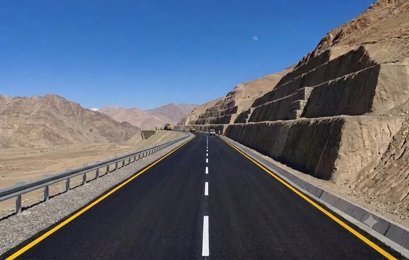 Mashkhel Panjgoor Road
Mashkhel Panjgoor Road
Feasibility Study and Detailed Design of the 200 km long Mashkhel Panjgoor Road - Pakistan
The Mashkhel–Panjgoor Road Project in Baluchistan is a strategic regional connectivity initiative aimed at strengthening the road network of South Baluchistan and improving connectivity between Gwadar, the northern regions of Pakistan, and the Iran border. The development is expected to enhance regional connectivity, support trade and economic activities, and strengthen Gwadar’s role as a key economic and logistics hub under the China–Pakistan Economic Corridor (CPEC). Improved road infrastructure in South Baluchistan will facilitate the movement of goods and passengers and promote socio-economic development across the region.
The Mashkhel–Panjgoor section comprises a 2-lane single carriageway, with the alignment starting near Qila Ladgasht in Mashkhel City and traversing predominantly flat and barren terrain. The route passes through settlements including Khaji, Nakheel, and Jahanabad before entering the hilly terrain of Rugwad Pass. From approximately Km 84+000 to Km 120+000, the alignment traverses hilly terrain, presenting varying topographical and geometric design challenges. A Panjgoor bypass was proposed to avoid resettlement impacts and facilitate efficient movement of through traffic. The project alignment terminates at National Highway N-85, where a T-intersection was proposed to provide safe and efficient connectivity and smooth traffic flow.
Managed and coordinated the highway engineering design, including horizontal and vertical alignment, geometric design, pavement design, junction/intersection design, and integration with the existing road network. Particular attention was given to the varying terrain, the proposed Panjgoor bypass, and connectivity with N-85. Key deliverables included detailed Design Drawings, Bill of Quantities (BOQ), Technical Specifications, Engineer’s Estimate, PC-1, and Tender Documents, providing complete and coordinated engineering documentation for project implementation and procurement.
 Swat Motorway
Swat Motorway
Detailed Design of 80 km long 4-lane Swat Motorway - Pakistan
The Swat Motorway Project comprised the detailed design of a four-lane, controlled-access motorway with full access control, a New Jersey Barrier (NJB) median, boundary fencing, and a 50–55 m Right-of-Way (ROW). The cross-section incorporated 3.65 m traffic lanes, 1.0 m paved inner shoulders, 3.0 m outer shoulders, and 0.5 m shoulder rounding, with provisions for future widening to six lanes at constrained sections to accommodate projected traffic growth. Pavement solutions were developed for waterlogged areas, incorporating capillary break layers and improved granular platforms to address seasonal groundwater fluctuations and maintain pavement performance.
The project included the design of eight grade-separated interchanges, automated toll plazas, permanent weigh stations, underpasses, flyovers, cattle creeps, pedestrian bridges with motorcycle ramps, two service areas, two rest areas, cross-drainage structures, motorway drainage systems, and associated road safety features. These facilities were designed to provide uninterrupted and safe movement of through traffic while maintaining connectivity for local communities, livestock, and agricultural vehicles and supporting the long-term operational efficiency and capacity of the motorway.
Managed and coordinated the detailed highway and infrastructure design, including motorway alignment and geometric design, pavement design, interchange and junction layouts, drainage and cross-drainage systems, access facilities, and associated road safety infrastructure. Coordinated multidisciplinary design to ensure compliance with applicable standards, constructability, operational requirements, and provisions for future traffic demand and capacity enhancement.
Key deliverables included Design Drawings, Bill of Quantities (BOQ), Technical Specifications, Engineer’s Estimate, Traffic Modelling, and Environmental Impact Assessment (EIA) Study, providing comprehensive engineering, traffic, environmental, and tender documentation for project implementation.
 Chaman Border Crossing Point
Border Crossing Points — Torkham & Chaman
Design Review and Construction Supervision of Border Crossing Improvements across 56 and 101 acres at Torkham and Chaman - Pakistan
The Border Crossing Point Improvement Project comprised the development and upgrading of border crossing facilities covering approximately 56 acres at Torkham and 101 acres at Chaman, aimed at improving border operations, traffic movement, passenger facilities, and supporting infrastructure. The project included comprehensive transportation, building, utility, and ICT infrastructure to support efficient and secure border-crossing operations.
Managed the assignment as Team Leader, providing overall leadership for contract administration, design review, construction supervision, consultant resource management, and quality assurance. SMEC’s scope included design review and construction supervision of road works, water supply, sewerage, electrical systems, IT and ICT infrastructure, bridges and culverts, rigid pavement for truck parking, administration and passenger terminal buildings, warehouses, staff accommodation, and associated facilities.
Responsibilities included preparation of the Inception Report, Monthly and Biannual Progress Reports, and Quality Assurance Manual; review and approval of construction drawings; review and approval of the baseline work programme; monitoring construction progress against the approved schedule; identification of delays and implementation of corrective measures; coordination with the Asian Development Bank (ADB) and Federal Board of Revenue (FBR); and administration of Interim Payment Certificates and contractual claims in accordance with the Contract Documents.
 King Abdul Aziz Road Project
King Abdul Aziz Road Project
3.65 km Design-and-Construct Corridor in Makkah - KSA
Development of urban corridor in the Holy City of Makkah under a Design and Construct framework, comprising a metro corridor with two stations, three multi-storey parking structures, pedestrian boulevard and underpasses, BRT, district cooling, electrical substation, utility corridors and associated infrastructure.
As Project Management Consultant, managed multidisciplinary design coordination and interfaces between transportation, infrastructure, buildings, utilities and specialist systems. Coordinated with the Contractor’s design consultants, Design Review Consultant, Client and stakeholders to monitor design progress, resolve technical issues and ensure compliance with project requirements and applicable standards.
Managed review and coordination of multidisciplinary design submissions, including design briefs, stakeholder and quality management plans, metro, parking, pedestrian, BRT, utility and infrastructure packages. Led weekly technical coordination meetings and facilitated timely resolution of design and construction interfaces.
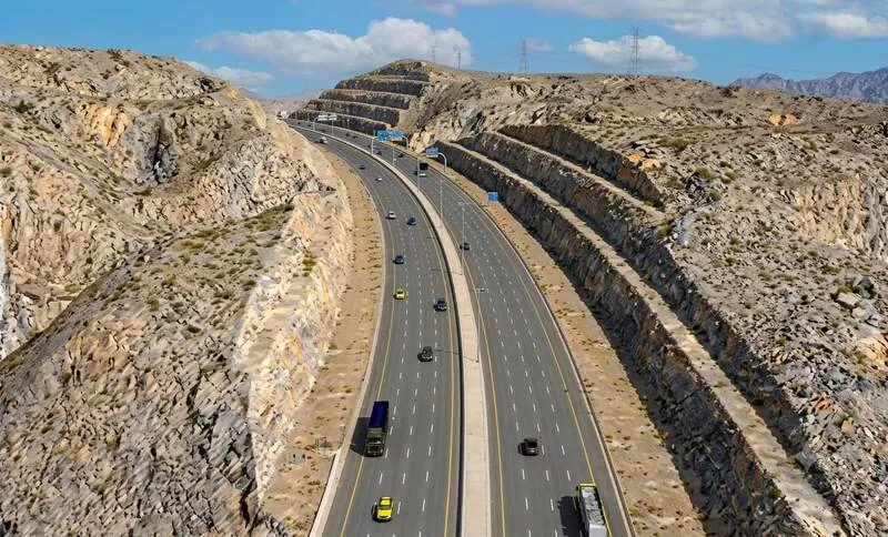
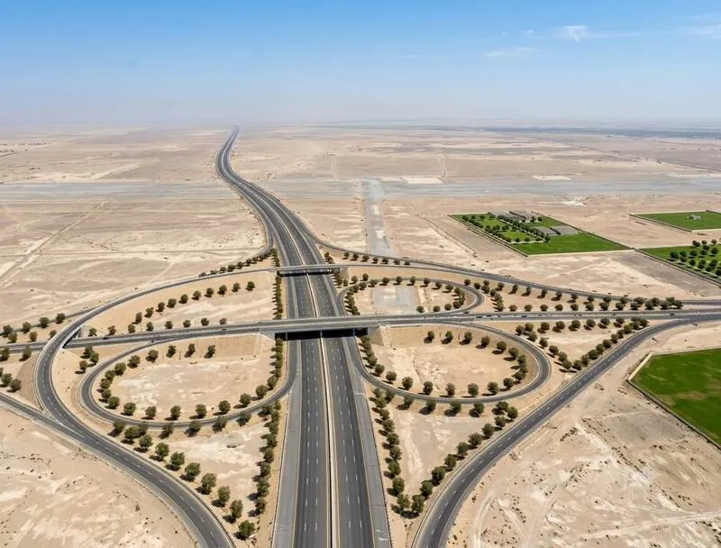 Batinah Expressway
Batinah Expressway
Detailed Design of 187 km 8-Lane Expressway and 187 Km 12 Link Roads Between Existing Batinah Highway and Proposed BEW- Oman
Detailed design of the 187 km, eight-lane Batinah Expressway (BEW) one of Oman’s major highway infrastructure projects. The project included 17 grade-separated interchanges, overpasses, rest areas, weigh stations, pedestrian bridges, 25 major wadi bridges, approximately 700 drainage culverts, coordination of 132 kV and 220 kV transmission line relocations, utility protection works and median safety barriers.
Managed the multidisciplinary design team and overall delivery of the detailed design, including coordination with the Client, stakeholders and utility agencies. Led technical coordination, managed design interfaces and ensured timely delivery of design and tender packages. Managed the tendering process in coordination with the Oman Tender Board, including responses to bidders’ queries, technical evaluation of bids and recommendations for the preferred contractor. Provided technical leadership and engineering support during construction.
Managed and coordinated preparation and delivery of the Prime Documents, Design Drawings, Bill of Quantities (BOQ), Special Specifications and Engineer’s Estimate, covering highway, interchange, bridge, drainage, utility and road safety works. Managed issuance of construction drawings and provided technical support for resolution of design and construction issues.
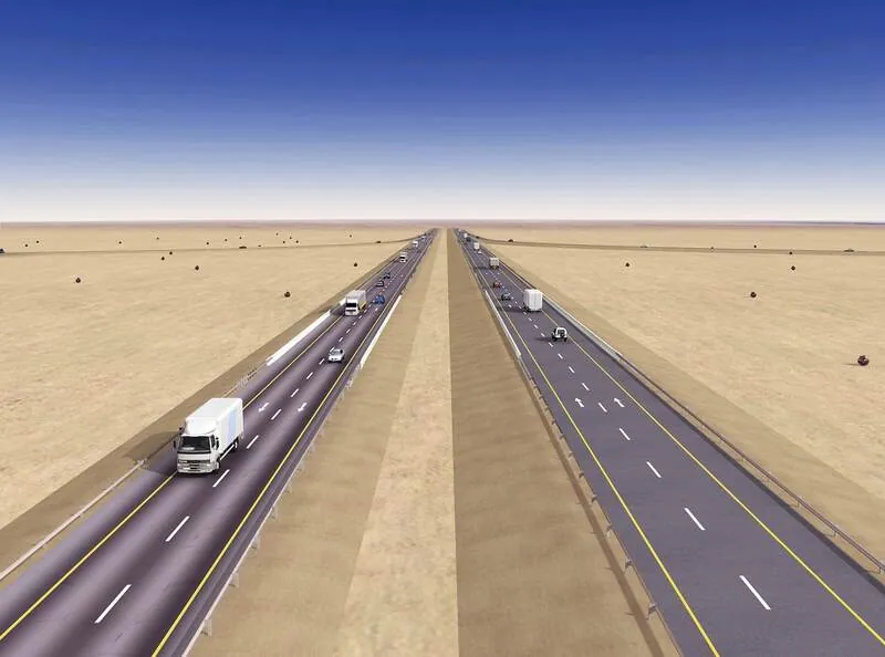
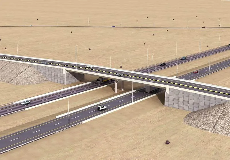
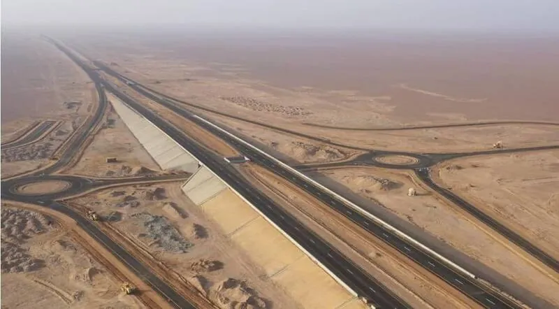 Dualization of Adam Thumrait Road
Dualization of Adam Thumrait Road
Upgrade 718 km from a Two-Lane Single Carriageway to a Four-Lane Dual Carriageway from Adam to Thumrait - Oman
Upgrading of approximately 718 km rural highway from a two-lane single carriageway to a four-lane dual carriageway from Adam to Thumrait in Oman. The project included 44 grade-separated interchanges, camel crossings, oil pipeline protection works, cross-drainage and median drainage culverts, lay-bys, weigh stations, rest areas and associated highway infrastructure.
Managed the multidisciplinary team for delivery of the detailed design and tender documentation within the agreed programme. Coordinated with utility authorities and statutory agencies, including securing approvals from the Royal Oman Police. Led the tender process in coordination with the Oman Tender Board, including responses to bidders’ technical queries, engineering clarifications and technical evaluation of bids. Prepared recommendations for the preferred contractor and provided technical leadership during construction.
Managed preparation and delivery of the Prime Documents, Design Drawings, Bill of Quantities (BOQ), Special Specifications and Engineer’s Estimate for the highway and associated infrastructure. Oversaw issuance of construction drawings and provided ongoing technical support to the construction supervision team for resolution of design and site issues.
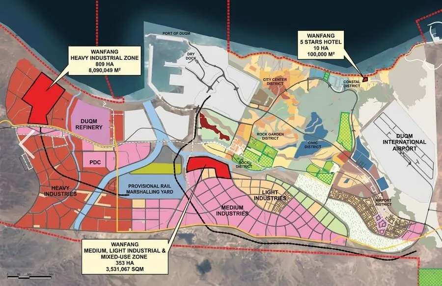 SEZAD Duqm Port Industrial Zone
SEZAD — Duqm Port Industrial Zone
Design and Supervision of a new 6-lane Dual Carriageway Road Network in Duqm Port - Oman
Design and construction supervision of a major industrial zone and new six-lane dual carriageway infrastructure within Duqm Port, Sultanate of Oman. The project included highway geometric design, stormwater drainage, ground improvement, street lighting, utility coordination and associated infrastructure supporting the port’s industrial expansion.
Managed multidisciplinary design coordination and supervised the design of grade-separated interchanges and associated infrastructure. Coordinated with the Client and key stakeholders to resolve technical issues, facilitate approvals and ensure compliance with project requirements, quality standards and contractual obligations. Managed design milestones and ensured timely delivery of project packages. The key challenge on this project was the unstable sabkha material which was stabilized by ground improvement.
Managed preparation and delivery of the Prime Documents, Design Drawings, Bill of Quantities (BOQ), Special Specifications and Engineer’s Estimate, including detailed design and tender documentation for interchanges, highways, drainage, ground improvement, street lighting and associated infrastructure.
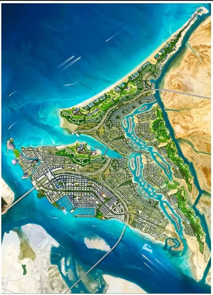 Saadiyat Island — Roads & Bridge
Saadiyat Island — Roads & Bridge
Detailed Design of 2,700-hectare Urban Development and 1.2 km long Saadiyat Bridge - Abu Dhabi - UAE
Development of the Saadiyat Island infrastructure and road network in Abu Dhabi, including a 1.2 km strategic bridge connecting Saadiyat Island with Abu Dhabi Island, a 600 m tunnel, complex grade-separated and at-grade interchanges, and extensive golf course and irrigation infrastructure.
Managed the highway design team and multidisciplinary coordination with structural, utility and specialist disciplines. Supervised planning and detailed design of the road network, including SPUI, diamond, directional, cloverleaf and roundabout interchanges, expressways, arterial, collector and local roads, and more than 40 intersections. Oversaw horizontal and vertical alignments, ROW plans, grading, earthworks and the Saadiyat Bridge and approach ramps. Also supervised irrigation lakes, subsurface drainage, pump facilities, desalination water conveyance, floodlighting and associated golf course infrastructure.
Managed delivery of schematic and detailed designs and preparation of multiple contract packages for TDIC tender. Deliverables included Design Drawings, road and interchange designs, bridge and tunnel infrastructure, grading and drainage plans, and golf course irrigation and drainage systems.
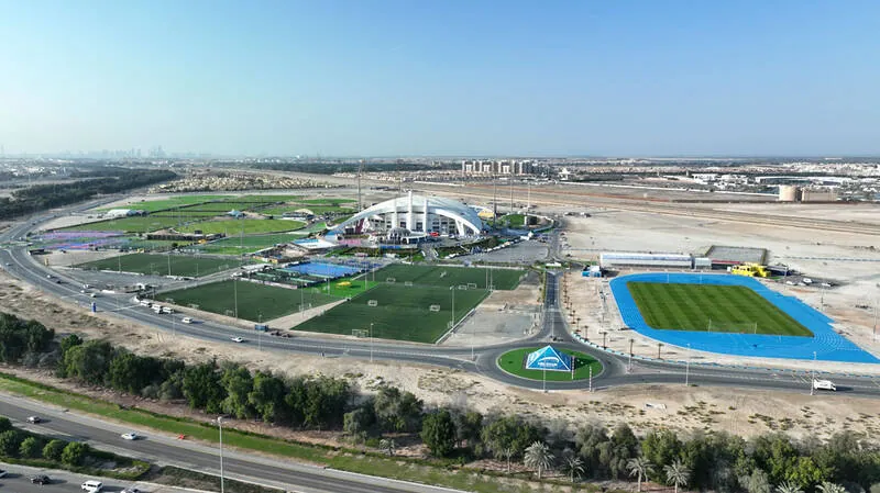 Roads & Parking in Sas Al Nakhl Area
Roads & Parking in Sas Al Nakhl Area
Development of Roads and Parking Areas around the Cricket Stadium in Abu Dhabi - UAE
Development of the road network and parking facilities surrounding the Abu Dhabi Cricket Stadium, including new access roads and connections to the existing dual carriageway network to improve traffic circulation, event-day operations and safe access for spectators, public transport and service vehicles.
Managed the geometric design of the road network, including junction layouts, lane markings, traffic signs, directional guide signs and parking facilities for approximately 5,000 buses and passenger cars. Coordinated with the Client and relevant stakeholders to ensure compliance with Abu Dhabi road design standards, operational requirements and project schedules.
Managed preparation and delivery of Design Drawings, Traffic Management Plans, Parking Layouts, including detailed road, junction, signage, marking and access arrangements.
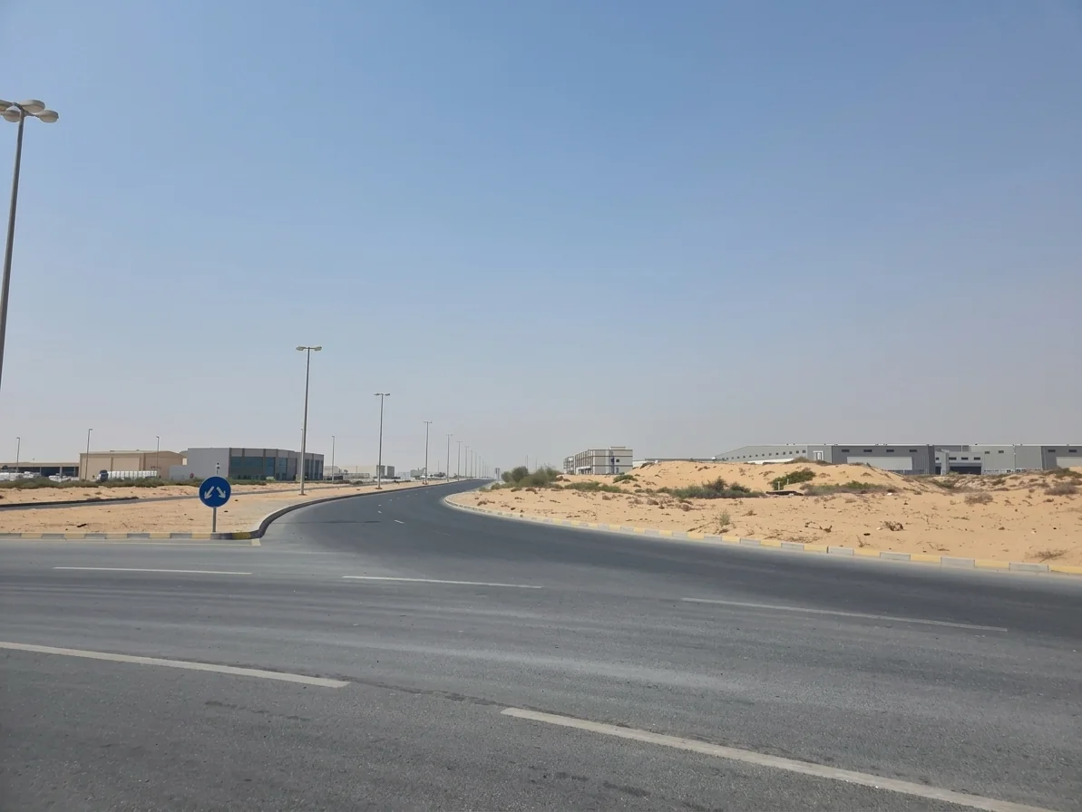 Sajaa Khawneej Dual Carriageway
Construction Supervision of Sajaa Khawneej Dual Carriageway, Dubai-Sharjah, UAE
An inter-state 4-lane dual carriageway designed for transportation of construction material from Dhaid to Dubai
As Principal Design Engineer, design the dual carraigeway in accordance with the UAE design Standards. As Resident Engineer, responsible for construction supervision of a 14 km long, 4-lane, access-controlled dual carriageway passing through sand dune areas and connecting Sajaa town (Sharjah) with Al Khawneej town (Dubai), UAE.
Responsibilities include seeking acceptance from key utility authorities through effective coordination throughout the construction phase of the project; contract management; evaluation of the Contractor's interim payment certificates; resolution of contractual issues and claims; correspondence with the Contractor and Client; preparation of monthly progress reports; bi-weekly meetings with Contractor and Client; preparation of the completion report; and handing over the site to the Client, including snag list closure.
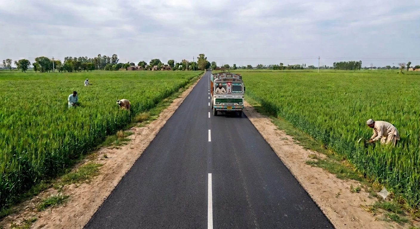
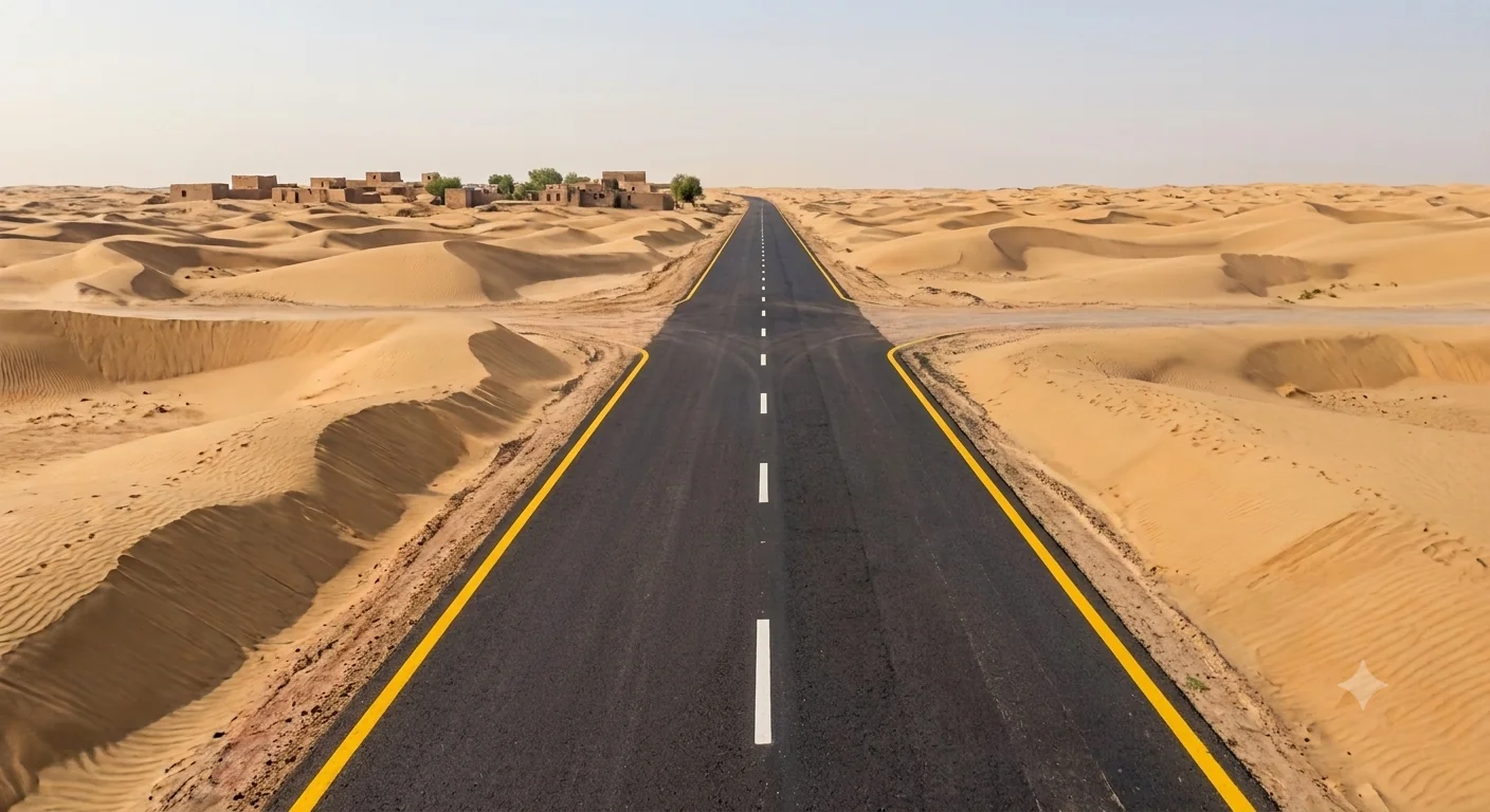 ADB-Funded Farm-to-Market Roads — Punjab, Pakistan
ADB-Funded Farm-to-Market Roads — Punjab, Pakistan
Design of approximately 323 km of Farm-to-Market Roads in Narowal, Bhakkar and Mianwali Districts, Punjab
The project comprised the development and improvement of approximately 323 km of Farm-to-Market Roads in the districts of Narowal, Bhakkar and Mianwali, Punjab. The ADB-funded road development programme was aimed at improving rural connectivity and providing better access between agricultural production areas, villages, local markets and the provincial road network. Such improvements supported agricultural and rural economic development by reducing transport constraints and improving access to essential services and market centres.
As Senior Engineer, was responsible for the geometric and pavement design of the road network, including development of horizontal and vertical alignments, typical cross-sections, earthworks requirements, drainage considerations and pavement structures appropriate to the anticipated traffic and subgrade conditions.
Responsibilities also included preparation and review of pavement design calculations, detailed engineering drawings, road cross-sections, construction details and tender drawings for the various road sections. Pavement designs were developed considering traffic loading, subgrade strength, material characteristics and applicable design standards to provide economical and durable road structures.
Prepared Bills of Quantities (BOQ) covering earthworks, pavement layers, drainage and associated road works, and coordinated the quantities with the detailed design and tender drawings. The assignment also involved preparation of tender documentation and technical inputs required for procurement and subsequent construction of the road works.
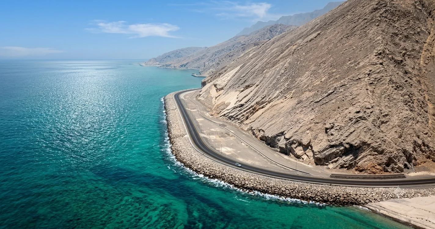
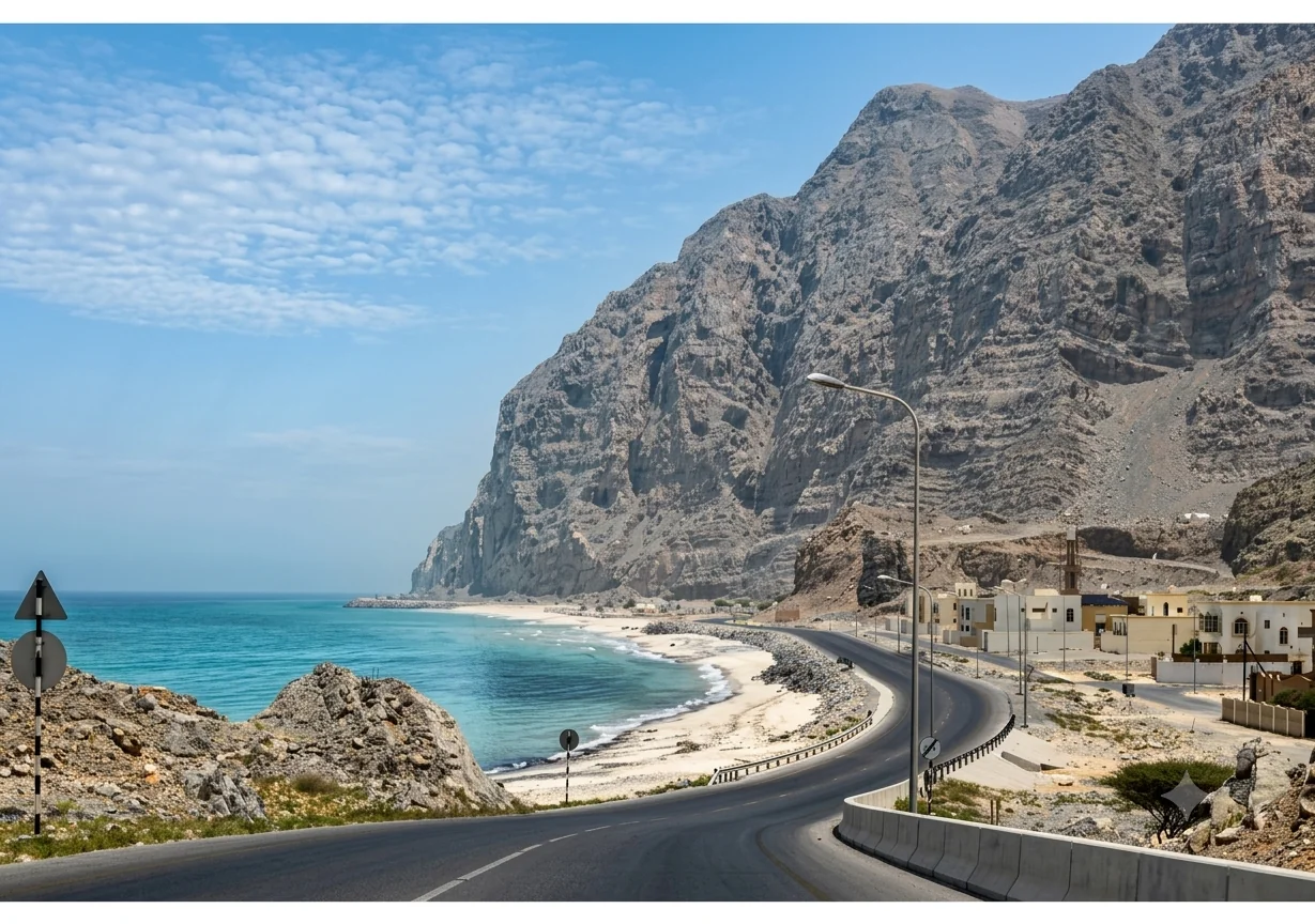
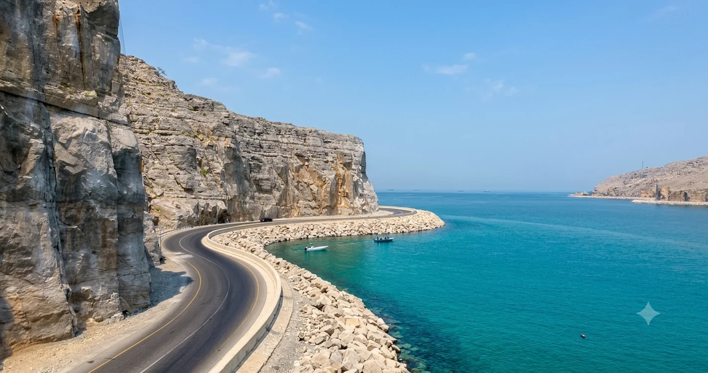 Khasab Coastal Road — Sultanate of Oman
Khasab Coastal Road — Sultanate of Oman
Detailed Design of a 42 km Coastal Road connecting Khasab with the coastal settlements of Musandam and extending towards Tibat
The Khasab Coastal Road comprised the design of an approximately 42 km coastal highway in the rugged Musandam Governorate of Oman. The road commenced at Khasab and passed through Uqda, Al Harf, Heey, Jadi and Bukha, extending towards Tibat. The route provided an important road connection to the coastal settlements and the UAE border area, while traversing steep mountainous terrain and sections immediately adjacent to the sea. The project was recognised for its challenging combination of coastal conditions and rugged mountain terrain.
As Senior Engineer, was responsible for the detailed design of the coastal road, including horizontal and vertical alignment, roadway geometry, earthworks, pavement and drainage requirements, and engineering solutions for sections constrained by the steep mountains and the sea. Particular attention was given to sections where the road alignment was located directly along the coastline and required construction of embankments into the sea.
A major engineering challenge was the design of the sea-facing embankment slopes and coastal protection system to withstand wave action, particularly the Shimal sea waves. The design incorporated rock-armour protection to safeguard the embankment toe and exposed slopes against wave attack, erosion and scour. The work required careful consideration of the coastal geometry, embankment stability, rock-armour sizing and placement, and integration of the road formation with the existing mountainous and marine environment. The resulting road became a notable engineering link along the Musandam coastline.
 ADB-Funded Farm-to-Market Roads — Punjab, Pakistan
ADB-Funded Farm-to-Market Roads — Punjab, Pakistan
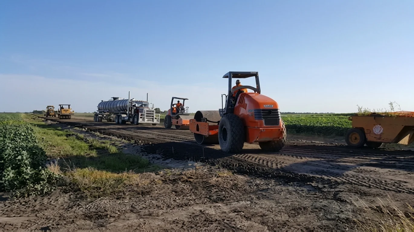
Construction Supervision of approximately 150 km of Farm-to-Market Roads in Jhang and Toba Tek Singh Districts, Punjab
The project comprised the construction supervision of approximately 150 km of ADB-funded Farm-to-Market Roads in the districts of Jhang and Toba Tek Singh, Punjab. The road development programme aimed to improve rural connectivity and provide better access between agricultural production areas, villages, main roads and local markets, facilitating the transportation of agricultural produce and supporting rural economic development.
As Resident Engineer, was responsible for the overall supervision and management of the Consultant's site supervision team, ensuring effective quality control and compliance of road construction works with the Contract Documents and approved specifications.
Responsibilities included contract administration, supervision and monitoring of road construction activities, quality control, measurement and evaluation of completed works, and review and certification of Contractor's interim payment certificates. The role also involved monitoring construction progress and ensuring that works were executed in accordance with the approved drawings, specifications and contractual requirements.
Maintained close coordination with ADB and C&W Department officials, Contractor's representatives and the Consultant's supervision staff to address construction issues, monitor project performance and facilitate timely implementation of the works. Prepared and submitted monthly project progress reports covering physical progress, construction activities, quality control, contractual matters and key project issues.
The project contributed to improved rural connectivity in Jhang and Toba Tek Singh Districts, providing better access for farming communities and facilitating the movement of agricultural produce to the main road network and nearby markets.
 Urban Roads in Al-Suwaidi Area — Riyadh, Saudi Arabia
Urban Roads in Al-Suwaidi Area — Riyadh, Saudi Arabia
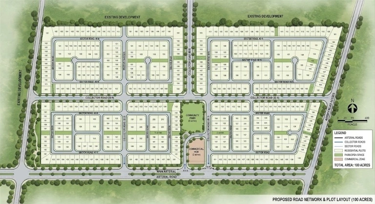
Design of approximately 90 km of Urban Roads in Al-Suwaidi Area, Riyadh
The project comprised the design of approximately 90 km of urban roads in the Al-Suwaidi area of Riyadh, Kingdom of Saudi Arabia, including arterial, collector and sector roads. The road network was planned to improve connectivity within the developing urban area and provide efficient access between residential, commercial and other land-use areas.
As Urban Road Design Engineer, was involved in the geometric design of arterial, collector and sector roads, including horizontal and vertical alignments, road cross-sections, junction layouts and associated roadway details in accordance with the requirements of Riyadh Municipality.
The assignment contributed to the development of an integrated urban road network, improving accessibility and traffic circulation within the Al-Suwaidi area of Riyadh.
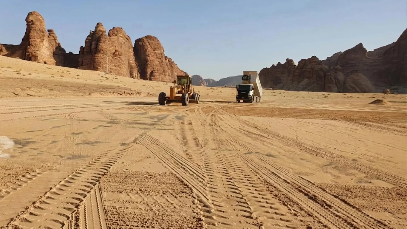
 Highway Construction Supervision — Kingdom of Saudi Arabia
Highway Construction Supervision — Kingdom of Saudi Arabia
Construction Supervision of Highway Projects in the Kingdom of Saudi Arabia
The assignment comprised construction supervision of highway projects undertaken by the Ministry of Communications in the Kingdom of Saudi Arabia, covering roadworks and associated highway structures.
As Site Engineer, was responsible for the supervision and quality control of earthworks, sub-base, aggregate base course, asphalt base and wearing courses, ensuring that construction activities complied with the approved drawings, specifications and contract requirements.
Responsibilities also included supervision of concrete works for bridges, culverts, retaining walls and concrete slope protection, including monitoring construction methods, workmanship and material quality. Reviewed and checked Contractor's shop drawings for culverts and bridges, ensuring compliance with design requirements and coordination with site construction activities.
The assignment provided comprehensive site supervision experience across highway pavement works, earthworks, drainage structures and major concrete works, contributing to the successful implementation of highway infrastructure projects in the Kingdom of Saudi Arabia.
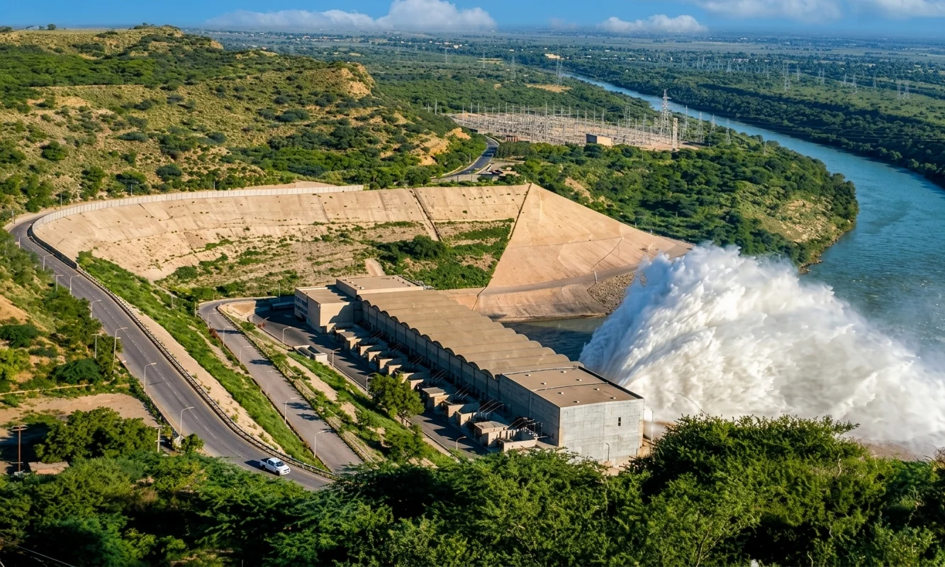 Mangla Hydroelectric Power Station Extensions 7 & 8 — Pakistan
Mangla Hydroelectric Power Station Extensions 7 & 8 — Pakistan
Structural Design of Civil Works for Mangla Hydroelectric Power Station Extensions 7 & 8
The project comprised the design of civil and structural works associated with Extensions 7 and 8 of the Mangla Hydroelectric Power Station, located on the Jhelum River in Pakistan. The extensions formed part of the development and expansion of the existing hydropower generation facilities.
As Structural Design Engineer, was responsible for the structural analysis and design of civil works associated with the power station extensions. The role included developing structural design solutions and ensuring that the designed works satisfied applicable engineering standards, structural safety requirements and project specifications.
The assignment provided experience in the structural design of major hydropower infrastructure and associated civil works, contributing to the expansion of the Mangla Hydroelectric Power Station.
Project Management Tools
04 / Tools & PlatformsA set of free, browser-based project management tools built from 48 years of roads and infrastructure practice. They are aimed at project managers, planners, quantity surveyors and engineering consultants who need to track schedule, cost, risk and progress during project delivery. Each tool runs entirely in the browser, needs no installation, and covers a specific task — from Gantt chart scheduling and earned value management to cash flow S-curves and risk registers. Looking for design calculators instead? See the Engineering Design Tools.
Project Management
- Design and Construction Gantt Chart — Prepare and manage design/construction schedules by entering activities, start and end dates, duration, holidays, project status and percentage completion. The tool also supports CSV import,export, automatically updating the activity table and Gantt Chart to monitor project progress and schedule performance. Also exports the chart in ppt format for further improving the font and color properties.
- Physical Progress Measurement Dashboard — Calculate overall project physical progress based on activity weights and percentage completion, with automatic comparison of planned vs. actual progress. Generate clear progress curves, activity-wise performance and dashboard summaries to monitor project status and identify delays.
- Cash Flow and S-Curve Calculator — Enter planned and actual monthly expenditure to monitor project cash flow and financial performance. The tool automatically generates monthly cash-flow charts and cumulative S-curves, enabling comparison of planned versus actual expenditure and early identification of cost variances. Pair it with the EVM calculator to link spend against earned value.
- Earned Value Management (EVM) Calculator — Enter the Planned Value (PV), Actual Cost (AC), and percentage of work completed to automatically calculate EV, SV, CV, SPI, CPI, EAC, ETC, VAC and TCPI. The software also generates performance graphs to provide a clear understanding of the project’s physical progress and financial health.
- Risk Register and Risk Matrix Template — Identify, assess and manage project risks using a structured risk register and 5×5 likelihood–impact matrix, with risk categorization, mitigation measures, ownership and status tracking. The tool supports CSV import/export, provides a real-time risk summary and visual risk profile, and facilitates proactive risk management and informed project decision-making.
- Claims/Extension of Time (EOT) Register — The Claims & EOT Register is a free, browser-based tool for efficiently tracking construction claims, Extension of Time (EOT) requests, delay notices and variation orders throughout the contract lifecycle. It records key dates, claimed and evaluated amounts, and EOT days requested and granted, providing a clear view of the project’s time and financial position. With powerful filtering, status tracking and contract clause references, it helps project teams maintain a structured and up-to-date claims record. A formatted Claims & EOT Status Report can also be generated instantly for printing or saving as PDF.
- Resource Loading Histogram — Plan and monitor manpower on a weekly or monthly basis. Generate resource loading tables and histograms to compare planned versus actual deployment, identify resource gaps, and support efficient project resource management.
- Action and Minutes of Meeting Tracker — Record and manage meeting actions, responsible persons, target dates and status, with automatic identification of pending and overdue actions. The tool helps track commitments and monitor timely closure of project decisions and actions.
- Change Order/Variation Order Register — This Variation Order Register provides a comprehensive tool for recording, monitoring, and managing contract variations throughout a project. It tracks variation details, approval status, values, dates, and their impact on the overall contract value and project duration. Interactive charts provide a clear visual summary of approved, submitted, and rejected variations, along with cumulative contract value trends. The tool supports effective cost control, change management, and project decision-making by keeping all variation records organized and up to date.
- Multi Project Financial & Performance Dashboard — This dashboard provides a consolidated view of financial and operational performance of multi projects, enabling management to monitor planned and actual costs, project contribution, invoicing, receipts, and outstanding debtors. It also presents key project scope, issues, and mitigation measures in a structured format. The dashboard supports management in assessing project financial health, identifying emerging issues, and taking timely corrective actions. It provides a clear, management-level overview of the financial and operational status of multiple projects.
- Project Health Dashboard — The Project Health Dashboard provides a concise overview of the overall health and performance of a project. It brings together key indicators such as cost, schedule, physical progress, risks, quality, and resource performance. The dashboard highlights emerging issues, delays, and cost pressures through clear visual indicators and performance trends. It enables project managers to quickly assess project status, take timely corrective actions, and generate professional project health reports for management and stakeholders.
- Lessons Learned Register — The Lessons Learned Register is a practical project management tool for systematically capturing, documenting, and sharing lessons from project events and experiences. It records what happened, the root cause, its impact, and the recommended action to prevent recurrence. The register helps project teams convert experience into actionable knowledge and improve future project performance. It can be used throughout the project lifecycle, from initiation and planning through execution, monitoring and closeout.
Frequently Asked Questions
How does the Design and Construction Gantt Chart work?
Enter each activity with its start date, end date or duration, and percentage complete, and the tool builds a Gantt chart automatically, tracking planned versus actual schedule and highlighting activities that are running behind. It supports CSV import/export and exports the chart itself for further formatting.
How is physical progress measured on a construction project?
Each activity is given a weight based on its share of the total project value or effort. As each activity's percentage complete is updated, the tool combines the weighted percentages into a single overall project progress figure, and compares that against the planned S-curve to show whether the project is ahead of or behind schedule.
What does a project cash flow and S-curve show?
The cash flow chart shows planned versus actual expenditure month by month, while the S-curve plots the cumulative version of the same data over the project timeline. Comparing the planned and actual S-curves makes cost overruns, underspend and financing gaps visible early, and pairs naturally with the EVM calculator for a fuller cost-performance picture.
What is a project risk register and risk matrix used for?
A risk register logs each identified risk together with its likelihood, impact, owner and mitigation plan. The risk matrix plots likelihood against impact to give each risk a priority score, so the highest-priority risks are easy to identify and track through to closure.
Can the Claims and Extension of Time Register give a quick view of pending actions and follow-ups?
Yes. Each claim or EOT request is logged with its key dates, claimed and evaluated amounts, EOT days requested and granted, current status and contract clause reference. Filtering and status tracking make it easy to see at a glance which claims are still open, what follow-up or response is pending, and where action is needed to keep the record current — and a formatted Claims & EOT Status Report can be generated instantly for printing or saving as PDF.
What is an Action and Minutes of Meeting template used for?
It provides a structured way to record the facts of each meeting — date, attendees and discussion points — alongside the specific actions required for the smooth running of the project: what needs to be done, who is responsible, and the target date. The tool automatically flags pending and overdue actions, so commitments are tracked through to closure rather than getting lost between meetings.
Can the Resource Loading Histogram track manpower for design consultants and contractors at each project stage?
Yes. Resource requirements can be planned and tracked separately for the planning, design and construction stages, and for each party involved — design consultants during planning and design, and contractors during construction. Enter planned and actual staff numbers by discipline or trade on a weekly or monthly basis, and the tool generates a resource loading table alongside a graphic histogram comparing planned versus actual deployment, making resource gaps and peak-demand periods easy to see at a glance.
What does the Change Order/Variation Order Register track?
It records each contract variation with its details, approval status, value, and dates, and shows the cumulative impact on overall contract value and project duration. Interactive charts summarise approved, submitted and rejected variations alongside the running contract value trend, giving a clear, up-to-date picture for cost control, change management and project decision-making.
Can the Multi Project Dashboard track financial status, pending invoices and issues for top management?
Yes. The Multi Project Financial & Performance Dashboard consolidates planned versus actual costs, project contribution, invoicing, pending invoices, receipts and outstanding debtors alongside project issues and their mitigation measures. Presenting all of this together in one management-level view helps top management quickly assess financial health across the portfolio and take timely, appropriate action on emerging risks.
How does the Project Health Dashboard check project health using KPIs?
It brings together key performance indicators — cost, schedule, physical progress, risk, quality and resource performance — into a single dashboard. Each KPI is tracked against its target and flagged with a clear visual indicator, so emerging delays, cost pressures and quality issues surface early enough for corrective action, and a project health report can be generated for management and stakeholders.
Can lessons learned be captured at the planning, design and construction stages?
Yes. The Lessons Learned Register is not tied to a single phase — it can be used throughout the project lifecycle, from initiation and planning, through design and construction, to monitoring and closeout. Each entry records what happened, the root cause, its impact and the recommended action, so lessons from earlier stages carry forward and improve decisions on later projects.
What is Earned Value Management (EVM)?
EVM measures project performance by comparing the value of work actually completed against what was planned and what it cost. From Planned Value, Actual Cost and percentage complete, the calculator derives EV, SV, CV, SPI, CPI, EAC, ETC, VAC and TCPI, and plots the results as performance graphs.
What do SPI and CPI mean?
SPI (Schedule Performance Index) is earned value divided by planned value, and CPI (Cost Performance Index) is earned value divided by actual cost. A value of 1.0 means on plan; below 1.0 means behind schedule or over budget; above 1.0 means ahead of schedule or under budget.
Are these engineering calculators free to use?
Yes. Every tool runs in your browser, requires no sign-up or installation, and is free to use. They are intended as design aids and preliminary checks — results should always be reviewed by a qualified engineer against the governing project specification.
Engineering Design Tools
05 / Tools & PlatformsA set of free, browser-based civil engineering design calculators built from 48 years of roads and infrastructure practice. They are aimed at highway engineers, design engineers and consultants who need quick, defensible numbers during feasibility and detailed design. Each tool runs entirely in the browser, needs no installation, and covers a specific task — from AASHTO pavement design to Manning’s equation drainage sizing. Looking for scheduling, cost or risk tracking instead? See the Project Management Tools.
Design
- Minimum Radius of Horizontal Curve Calculator — Calculates the minimum radius of a horizontal curve for 4%, 6% and 8% superelevation and design speeds ranging from 20 kph to 130 kph.
- Vertical Alignment Design on Straight Line Calculator — Computes finished elevations along a straight vertical grade at any station or fixed interval, including pavement-edge and shoulder-edge elevations for a standard crowned cross-section. It is particularly useful for land grading, gore areas, intersections, and roundabout design.
- Vertical Alignment Design on Tangent and Parabolic Curves Calculator — Computes finished elevations along tangent grades and parabolic vertical curves at any station or fixed interval, providing accurate roadway profile elevations. It also verifies crest and sag curve designs against stopping sight distance requirements for the selected design speed. See also the horizontal curve radius calculator for the matching plan geometry.
- Flexible Pavement Design Calculator (AASHTO) — Evaluates Single, Tandem, and Tridem Axle Load Equivalency Factors (LEFs) using AASHTO pavement design tables and calculates cumulative Equivalent Single Axle Loads (ESALs), including traffic growth over the selected design period. The calculator determines the required Structural Number (SN) and designs the asphalt, base, and subbase layer thicknesses based on cumulative ESALs, subgrade CBR, reliability, drainage conditions, and other AASHTO design parameters. It provides a safe, economical, and practical flexible pavement structure for the selected design life. The calculator also generates a comprehensive design report explaining axle load equivalency factors, traffic loading, ESAL calculations, Structural Number determination, and the complete flexible pavement design procedure.
- Rigid Pavement Design Calculator (AASHTO) — Evaluates Single, Tandem, and Tridem Axle Load Equivalency Factors (LEFs) using AASHTO pavement design tables and calculates cumulative Equivalent Single Axle Loads (ESALs), including traffic growth over the selected design period. The calculator determines the required thickness of concrete slab based on cumulative ESALs, subgrade CBR, reliability, concrete strength and other AASHTO design parameters. It provides a safe, economical, and practical rigid pavement structure for the selected design life. The calculator also generates a comprehensive design report explaining axle load equivalency factors, traffic loading, ESAL calculations, concrete slab thickness determination, and the complete rigid pavement design procedure.
- Single and Dual Carriageway Cost Estimator (under development) — Calculates the cost estimate for single and dual carriageway roads based on user-defined cross-section geometry, including carriageway and shoulder widths, embankment side slopes, pavement layer thicknesses, subgrade, and embankment thicknesses. The program also allows users to add quantities and rates for road furniture, drainage structures, culverts, bridges, and miscellaneous items not covered under the main road components, providing a comprehensive project cost estimate.
- Box Culvert Quantities Calculator — Calculates quantities of a box culvert from user-defined culvert barrel dimensions and standard headwall geometry (parapets, wing walls, aprons, and toe walls). Calculates the structural excavation, concrete (above ground, underground, and elevated), lean concrete, reinforcing steel, and riprap quantities. The calculator also estimates construction costs using user-defined unit rates.
- All Box Culverts on a Road Project Quantities Calculator — Calculates quantities for multiple box culverts from user-defined barrel dimensions and standard headwall geometry, with culvert data imported from a CSV file and unit rates provided in a text file. The calculator determines structural excavation, concrete (above ground, underground, and elevated), lean concrete, reinforcing steel, and riprap quantities for each culvert and the overall project, and estimates construction costs using user-defined unit rates. For a single structure, use the single box culvert quantities calculator.
- Pipe and Open Channel Flow Calculator — Calculates stormwater runoff from rainfall intensity, catchment area, and runoff coefficient, then designs the required pipe or channel size using Manning’s equation. Useful alongside the box culvert quantities calculator when sizing and costing road drainage crossings.
Frequently Asked Questions
What is a flexible pavement design calculator?
It is a tool that sizes the layers of an asphalt pavement. This one follows the AASHTO method: you supply cumulative axle loads (ESALs), subgrade CBR, reliability, drainage and the other AASHTO design inputs, and it returns the required structural number (SN) together with asphalt, base and subbase layer thicknesses for the chosen design life.
What inputs are required for AASHTO pavement design?
For flexible pavement: cumulative ESALs over the design life, subgrade CBR, reliability level, overall standard deviation, serviceability loss and drainage coefficients. For rigid pavement: cumulative ESALs, concrete strength, subgrade support, reliability and the related AASHTO design parameters.
What is the difference between flexible and rigid pavement design?
Flexible pavement spreads load through layers of asphalt, base and subbase, so the output is a structural number and a set of layer thicknesses. Rigid pavement carries load in a concrete slab, so the output is a required PCC slab thickness, checked against the provided lean concrete and granular subbase.
What is Manning’s equation used for?
Manning’s equation relates flow velocity in a pipe or open channel to its hydraulic radius, slope and roughness coefficient. The pipe and open channel flow calculator uses it to size the pipe or channel needed to carry the stormwater runoff generated from your rainfall intensity, catchment area and runoff coefficient.
Are these engineering calculators free to use?
Yes. Every tool runs in your browser, requires no sign-up or installation, and is free to use. They are intended as design aids and preliminary checks — results should always be reviewed by a qualified engineer against the governing project specification.
Credentials
06 / QualificationsAcademic
- B.Sc. Civil Engineering
University of Engineering & Technology, Lahore, Pakistan — 1978
Memberships & Training
- Member, Pakistan Engineering Council (CIV-3794)
- Member, The Institute of Engineers Pakistan
- Inhouse Project Management Course in Parsons
- PMP (PMI)- Training Course
- Project Control and Project Budget Control Management
- Writing and Presentation Skills
- Total Quality Management and Quality Assurance Procedures
- Work Load and Time Management
Computer Skills
- Used extensively Highway design software RoadCalc, Geopak, InRoads
- Developed highway design software in MS Visual Basic (VB)
- Developed Quantities of Culverts Software in VB
- Developed VB macros in Excel
- Developed VB macros in MicroStation
- Developed AI tools in Python
- Developed this Portfolio using AI and personal computer skills (+40 years)